Jeronymo Dalapicolla is a postdoc at the Instituto Tecnológico Vale in Brazil. He is an evolutionary biologist interested in the impact of landscape features on evolutionary processes. Here, Jeronymo shares his recent work on the influence of different forest associations in the genetic variation of two sympatric species of spiny rats in the Western Amazon.
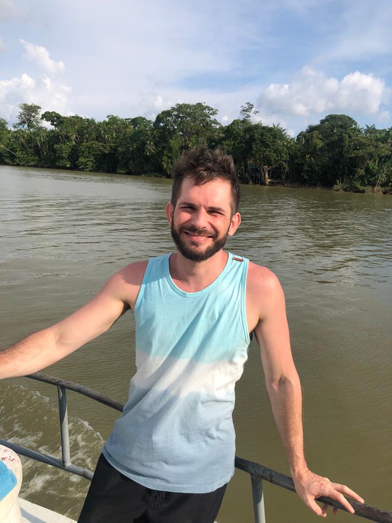
Jeronymo in a boat on Guamá River, Brazil.
Personal links. Twitter | Instagram | Research Gate
Institute. Instituto Tecnológico Vale (Belém, Brazil)
Academic life stage. Postdoc
Major research themes. Phylogenomics, Landscape Genetics, Conservation Genetics, and Statistical Phylogeography of Neotropical Mammals and Plants.
Current study system. Proechimys is a genus with more than 20 species of spiny rats (rodents closely related to capybaras and cavies) distributed throughout the Amazon basin. Given its distribution, this genus is an excellent model to study the evolutionary processes that generated current Amazonian biodiversity patterns. Furthermore, there is an unusual fact: the high rate of sympatry and syntopy between species of Proechimys. Usually, different species in the same Neotropical rodent genus show parapatric or allopatric distributions, with rare cases of sympatry. However, up to five species of Proechimys can be sampled in the same area, sometimes even in the same trapline! Which makes this genus more intriguing to study how species can use the landscape/habitat.
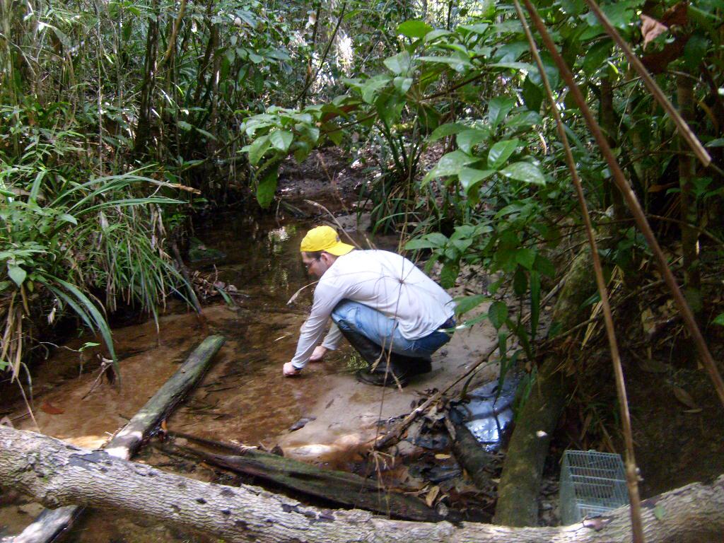
Jeronymo installing traps to collect rodent samples during fieldwork for his PhD.
Recent JBI paper. Dalapicolla, J.; Prado, J. R.; Percequillo, A. R.; Knowles, L. L. Functional connectivity in sympatric spiny rats reflects different dimensions of Amazonian forest-association. J. Biogeography, 48(12): 3196-3209 https://doi.org/10.1111/jbi.14281
Motivation behind this paper. I was greatly influenced by the work of Latin and North American mammalogists. One of these works was performed by James Patton’s group (UC Berkeley) using sympatric species of Proechimys and mitochondrial DNA (mtDNA) to test how gene flow occurs between river banks in the Amazon (Matocq et al. 2000: https://doi.org/10.1111/j.0014-3820.2000.tb00574.x). In general, their results confirmed an established premise for the species inhabiting seasonal floodplain forests where this habitat works as linear corridors to dispersal along the river. In contrast, in inland areas (non-flooded forests), species should present more restrictive dispersal patterns. However, Patton’s group also found some peculiar results, with some species not entirely fitting this premise. So, our goal using genomic data was to effectively test whether habitat preference impacts levels of gene flow and genetic diversity patterns. Also, we aimed to clarify why some of the previous results based on mtDNA did not fit in the general premise for seasonal floodplain forests.

Spiny rat (Proechimys sp.) collected on non-flooded forests close to the Madeira River, Rondônia, Brazil (Photo by J. L. Souza).
Key methodologies. Comparative studies on phylogeography and landscape genetics with mammals usually employ phylogenetically distant species living in the same area to look for similar patterns of diversification. The particularity of our study was to use closely related species (all in the same genus) living in the same area but showing differences in habitat preferences. Another key for our study was to use mixed models to analyse isolation-by-resistance. By doing it, we were able to control for spatial autocorrelation and for pairwise comparisons effect to improve the models’ explanations. Moreover, I consider that the landscape variables we generated representing characteristics of different habitats are also new insights going further than classical temperature and precipitation variables typically used in evolutionary studies in the Amazon region.
Unexpected challenges. Using genomic data may be commonplace for most researchers from the Global North. However, it is still challenging and expensive for researchers from Brazil like me (and other countries in the Global South). Studies involving genomics in Amazonian mammals are still scarce. As I mentioned above, this work was motivated by Matocq’s study, and we thought we would confirm their results and explain some results that did not fit the initial premise on habitat preferences. However, by using more data and increasing the scale, we were surprised that we didn’t corroborate the previous results. Indeed, we demonstrated that habitat preferences assumptions might sometimes oversimplify the real world and might not be the primary driver explaining genetic and diversity patterns.

Putumayo-Içá River in Amazonas, Brazil (Photo: R. Recorder).
Major results. Biologists have been highly dedicated to explaining the diversity patterns of species, especially in mega-diverse regions, such as Amazon. These explanations typically use hypotheses about major historical events (e.g., climate change, mountains uplift, river as barriers) to explain current diversity. Researchers often look for concordance of patterns in different species to indicate the existence of a unique or generalizable factor to explain the diversity. Our study shows that premises like “species from seasonal floodplain forests have low structure and high gene flow” are not completely accurate for the entire biota, which can bring important conservation implications. So, understanding the relationship between ecology and how different species use the landscape can be more important in explaining diversity patterns in some instances than historical events. In addition, in this study, we applied modern analytical methods that can be used in other studies – with all scripts, data, and examples available as supplementary material (Dryad; GitHub).
Next steps for this research. We still have lots of work to do with this rodent group and the Amazon. Our research group is focused on unravelling the patterns of diversity of small Amazonian mammals to promote a better understanding of the evolution of the Amazonian region to provide key information for the conservation of this biome. Specifically, about the Proechimys, we are working on the species delimitation for the genus and the taxonomic rearrangements using morphological data. We hope to share these results as soon as possible.

Boat on Putumayo-Içá River during a scientific expedition in Amazonas, Brazil (2015) to collect material for the Zoology Museum of Universidade de São Paulo during my PhD (Photo: I. Prates).
If you could study any organism on Earth, what would it be? It’s funny how our expectations change, right? When I was an undergrad student, I dreamed about studying Marine Biology, especially turtles and cetaceans. Today I don’t see myself studying any marine organisms – I’m not a good swimmer! Although I love living close to the ocean, it was another expectation that didn’t work! Considering terrestrial organisms, I have a fascination for big cats and would love to study them, preferably in the field.
Anything else to add? Although I like working in the molecular biology laboratory, I have three passions in Biology. The first is fieldwork, data collection, and contact with nature, which always brings insights and important research questions. My second passion is museums and scientific collections. I spent a good part of my academic life managing regional mammal collections in Brazil and a lot of my Ph.D. time in collections gathering data. My research wouldn’t be possible without these institutions, so I have to thank them so much! My third passion is teaching. I started teaching in elementary and high school more than ten years ago, and now I teach graduate courses at the Vale Institute of Technology. I love to share what I’ve learned with other people – it’s a rewarding job! I’m known among my colleagues and friends for the tutorials and “how-to-do” scripts that I like to create, explaining in detail all the steps of analyses or software’s use. I always get emails asking if I have a tutorial or material about some analysis and if I could help solve some issues. I understand that the knowledge I gained from my professors is my heritage, and using it to help others is wonderful. Sharing knowledge is probably my most precious legacy for future generations.

Sunset in Solimões River during the scientific expedition to Putumayo-Içá River, Amazonas, Brazil (2015) (Photo: R. Recoder).


 .
.


